Product information
LOGOS GCS is an advanced software for controlling unmanned aerial vehicles (UAVs). Our product ensures reliable and efficient control of drones, providing users with a wide range of capabilities for various tasks.
Key Features:
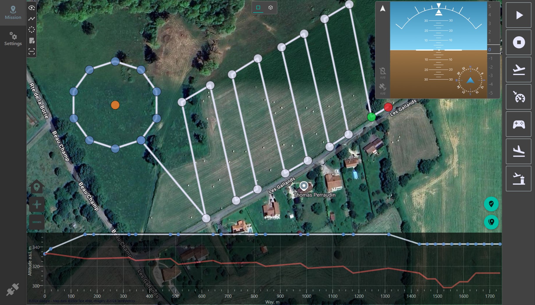
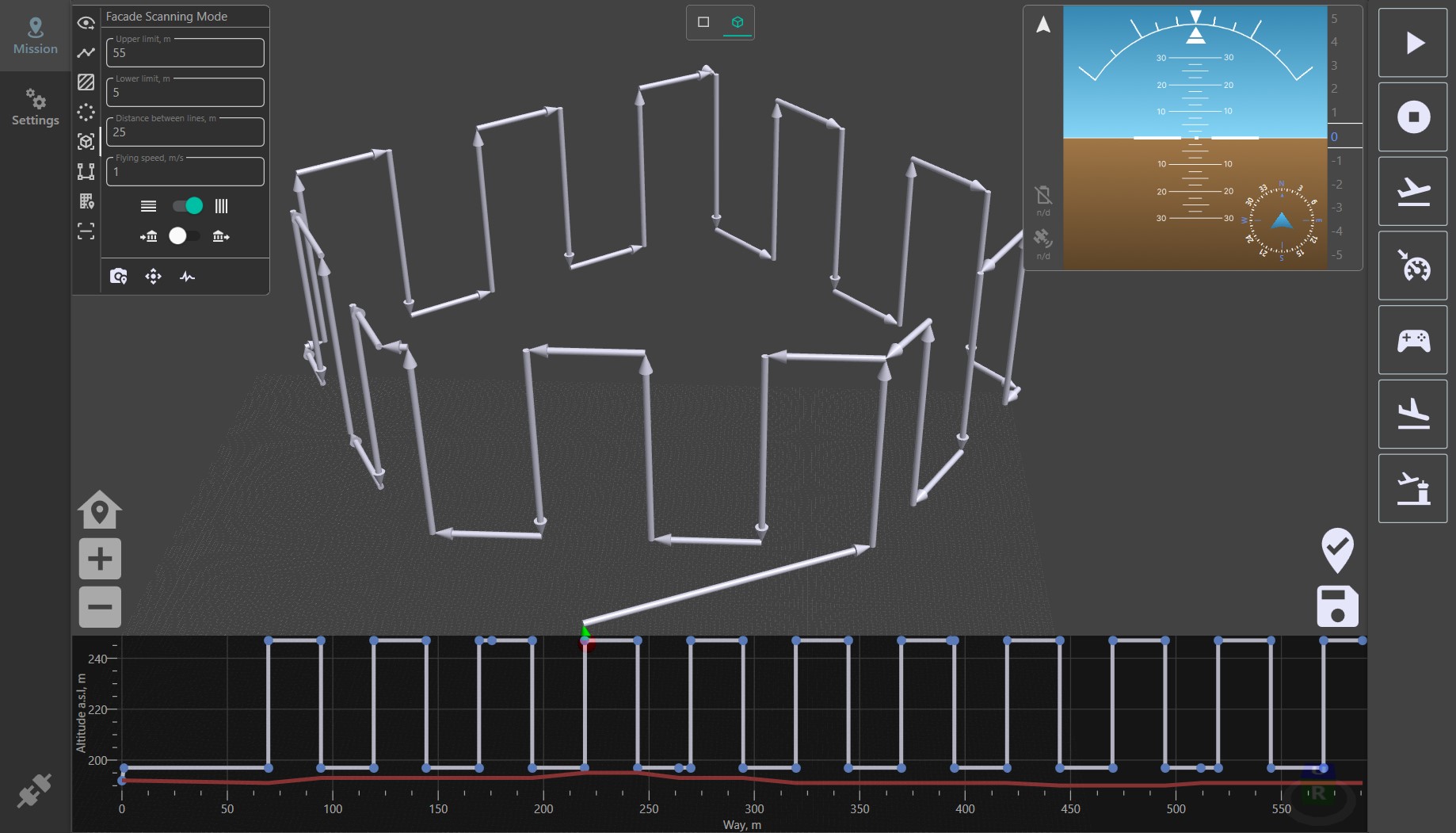
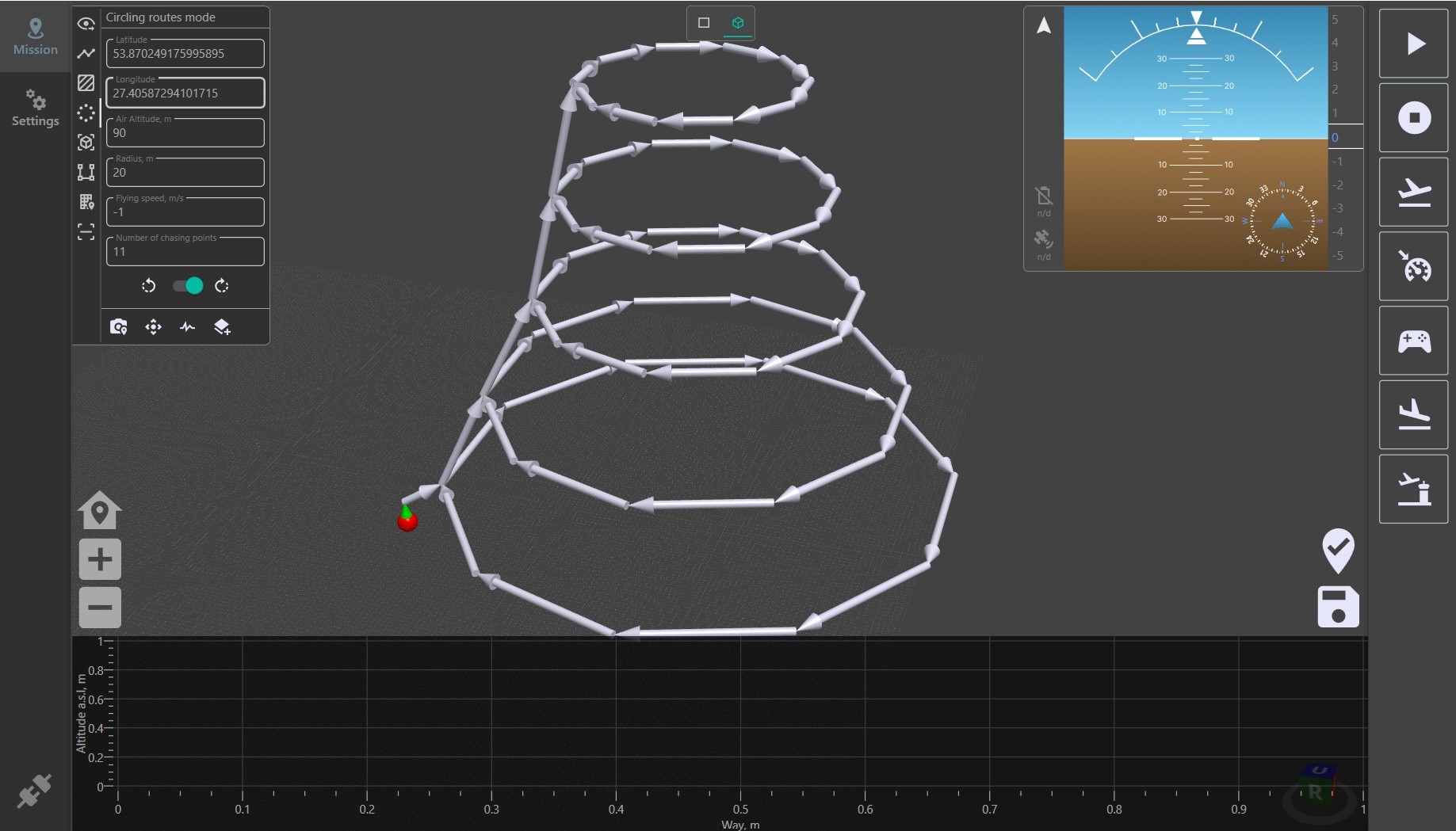
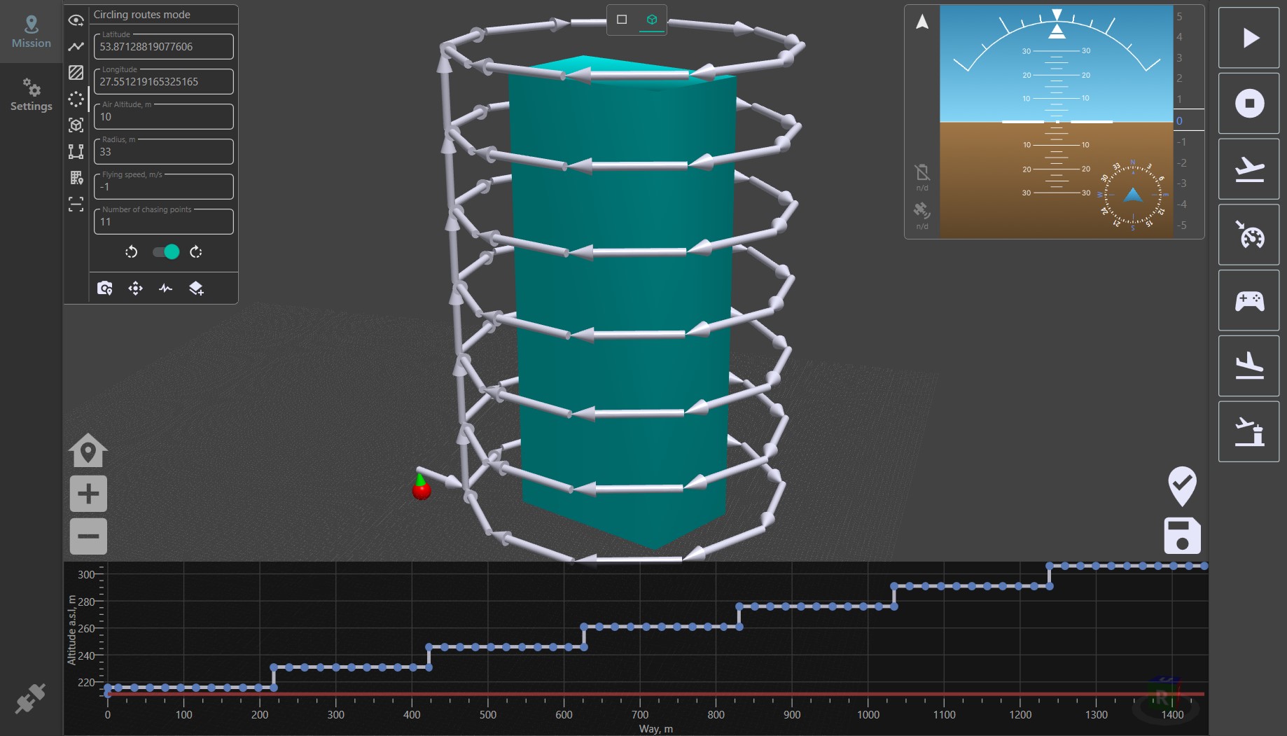
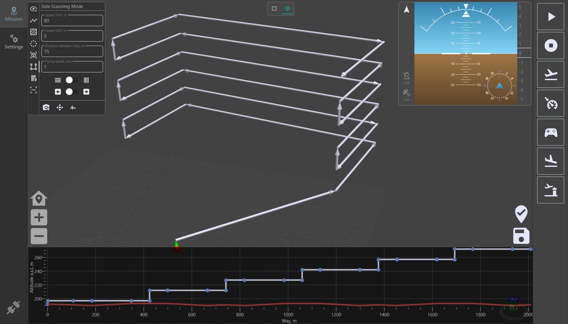
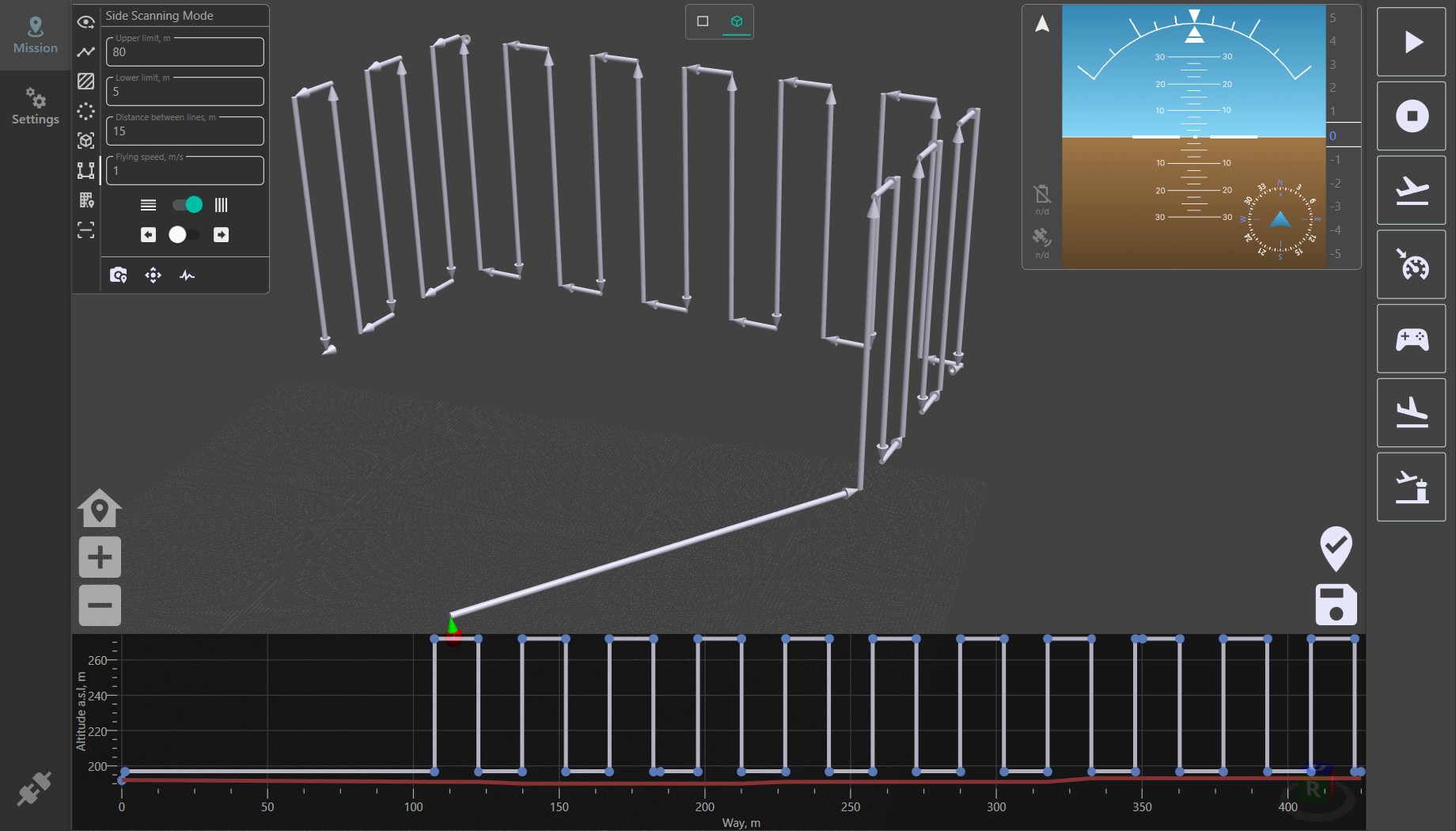
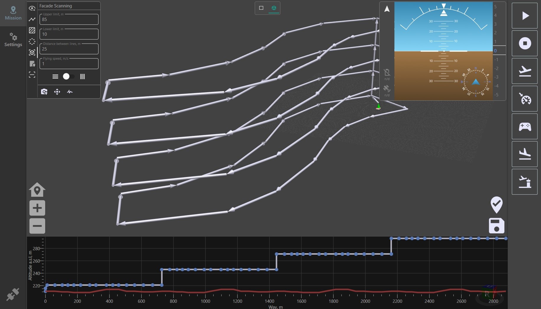
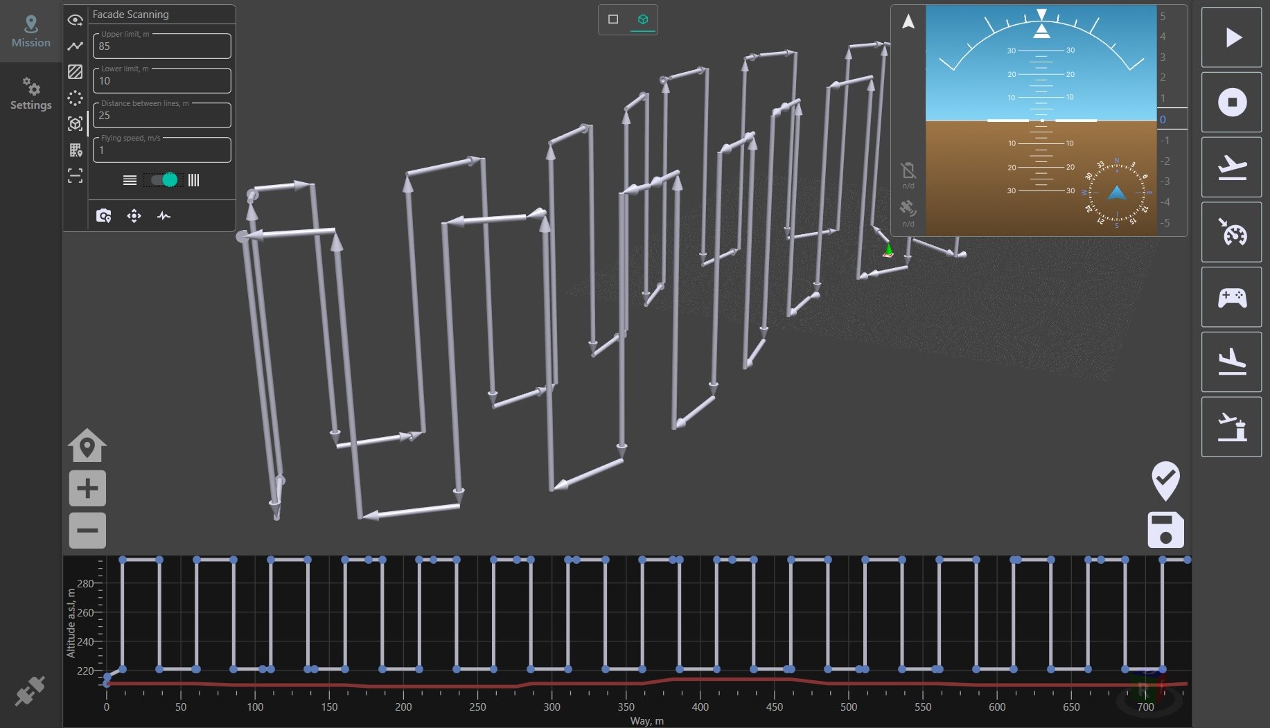
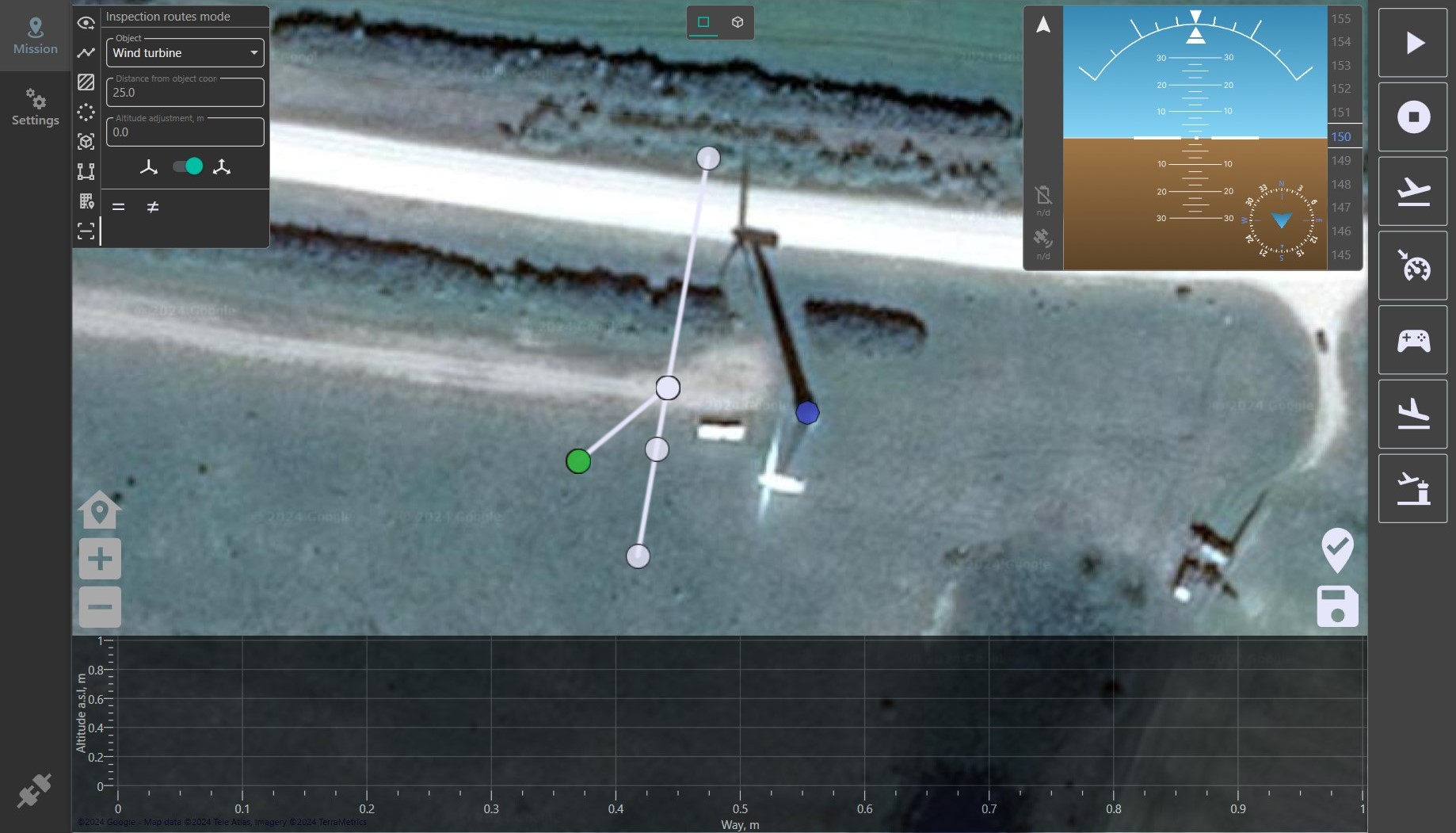
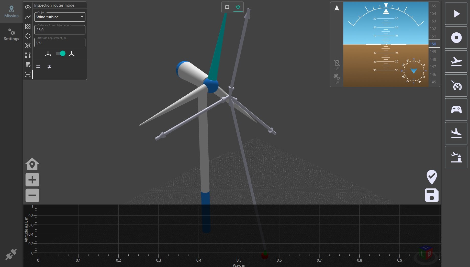
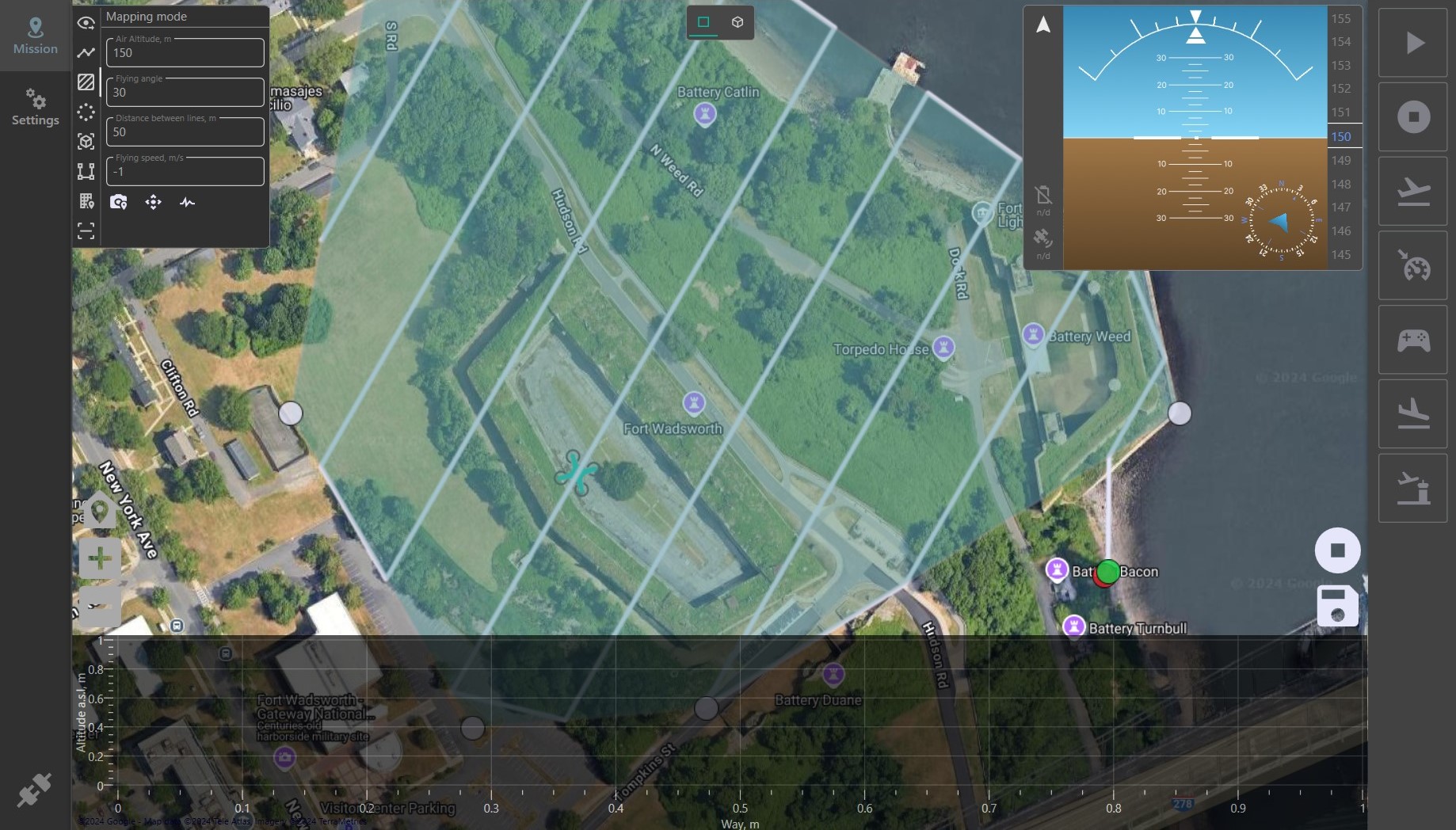
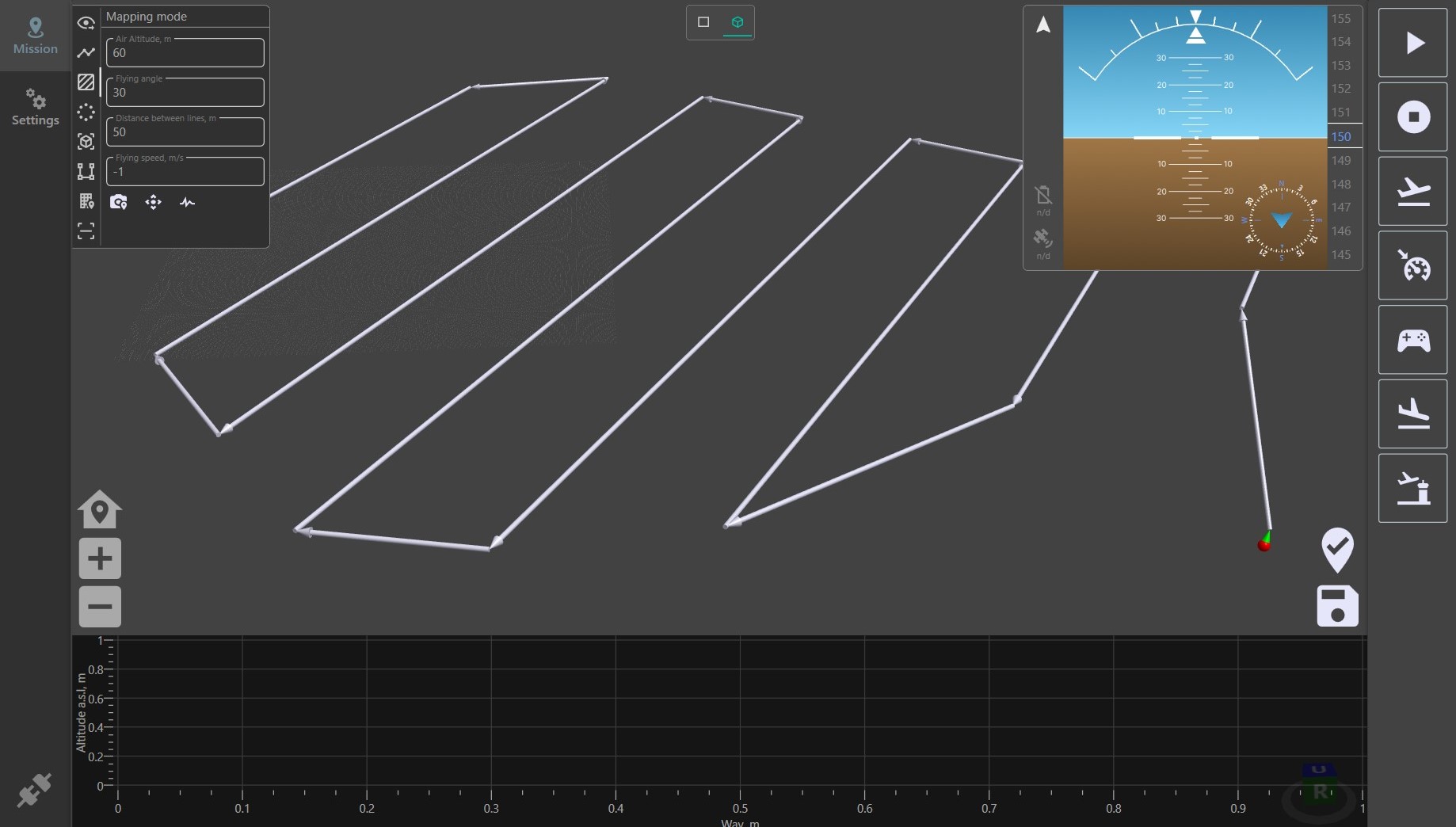
- 3D View Mode: Streamlines the planning of complex routes.
- Physical Object Snapping: Provides precise control of drones near buildings and other objects.
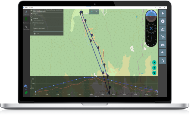
- Built-in Simulator: Allows users to simulate and test missions before executing them, increasing the safety and efficiency of operations.
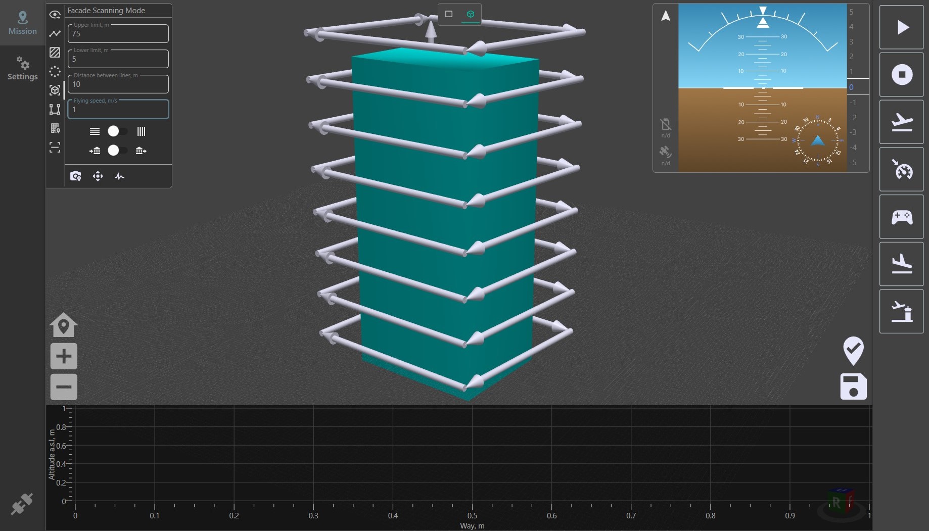
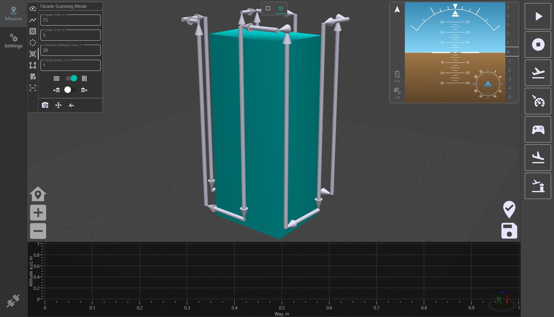
- Automatic Route Planner: Ideal for tasks such as wind turbine blade inspection that automatically creates routes taking into account every detail.
Advantages
- ArduPilot Compatibility: Provides wide integration and use options with various drone models.
- DJI Support: Allows you to export any flight mission created in the program to the .kmz format supported by DJI industrial drones.
- High Accuracy and Reliability: Our software guarantees stable control and minimizes errors.
- Innovative Features: Constantly updating and adding new features, such as scanning of building facades, inspecting objects and mapping.
- Ease of Use: An intuitive interface and easy setup make the program accessible to users of any level.
When working with Ardupilot technology, you will also need to have basic knowledge of drone design, which you can obtain by reading the following article on our website: How to build a drone
The software is created for wide variety operating systems including Windows, Linux and MacOS.
For more information on using the GCS please follow the documentation.
Use cases
Cargo delivery with UAVs
Build routes in just few minutes. Deliver food, equipment, medicine to disaster areas or organize search and rescue expeditions.
Learn more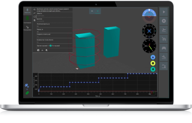
3D photogrammetry with drones
Plan photogrammetry missions to digitize buildings. No need to train or hire pilots of PRO level. LOGOS GCS is what you actually need.
Learn more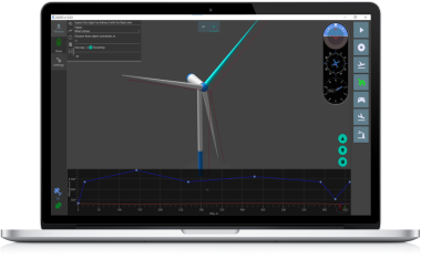
Wind turbines maintainance
Create routes to maintain wind turbines. Save your time and money, protect your team from casualties. Let it be an easy part of your business.
Learn morePricing
- For Individuals
- For Business
- Full featured GCS
- Unlimited number of flight missions
- All the updates during license validity
- 3D mode for modeling spot missions
- $0 discount
- Full featured GCS
- Unlimited number of flight missions
- All the updates during license validity
- 3D mode for modeling spot missions
- $60 discount
- Full featured GCS
- Unlimited number of flight missions
- All the updates during license validity
- 3D mode for modeling spot missions
- $120 discount
- Lifetime license for one computer
- Support of UAVs on MavLink2
- All available GCS functions
- Expanding GCS functionality
- One-time payment
- All available GCS functions
- Protocol customization
- One-time payment
- All available GCS functions
Did not find an option for your requirements?